Thursday, July 23, 2015

LIFE IN DUBLIN AFTER THE CIVIL WAR


An Oral History


They were born during the last years before the Civil War divided America.  They grew up during the horror of that war and the hard times which followed.  From those primitive times, the Stevens sisters witnessed a most miraculous transformation in America.  During their long lives, the sisters witnessed the coming of electric lights, radio and television.  They were transported by horses, railroads, automobiles and airplanes.  This is their story.


Anna, (left)  the eldest daughter of Joseph E. Stevens was born in Laurens County on October 11, 1859.  Ella, the youngest daughter, was born on January 28, 1861 as the legislatures of the Southern states were debating the issue of secession.  Too young to understand the cataclysm whirling around them, the girls were not too young to know that their father, a corporal of Co. C. of the 57th Georgia infantry, was killed near Vicksburg, Mississippi while on picket duty.  Their mother, Margaret,  was a daughter of Edwin and Malinda Holmes.


The Stevens girls  were born and raised reared in  Dublin. Their father, whom they barely remembered, came here in the mid 1930s.  Before he enlisted in the Confederate Army, he helped to build the court house, which was still standing until the 1930s and was known as the Court Square Hotel.


Way back in the autumn of 1931, the sisters sat down with a Dublin Courier Herald writer to reminisce about the days of their youth, long ago in Dublin, Georgia.  That account was published in the November 14, 1931 edition of the Dublin Courier Herald:


There was only one physician, Dr. Hudson, who was followed by Dr. Harris Fischer and Dr. Peyton Douglas.  There were only two church denominations here in our youth, Baptist and Methodist with only one church Building. The building stood on the same place where the First Baptist church now stands.  When the city was ready to build a new church, the old building was razed and given to the colored people to build them a church, which was used for a number of years for both worship and school purposes.


             There was only one school building in the city at that time, which stood on the site where the High School Building now stands.  It was still being used when Horace and  Effie Geffcken reached the school age and they entered their school life there. The mail service was poor at that time.  It was sometimes brought on horseback or in a buggy from Toomsboro, as that was the nearest railroad station. The mail was often delayed for several days at the time, especially in rainy weather as there was no bridge across Hunger and Hardship Creek.


              In 1871, the mother of these two women died. They remember and can give the names of each person who lived in Dublin at that time. The list follows:  Col. E.C. Corbett and family; Charlton Smith, farmer; Col. James Thomas, Proprietor of the Old Troop Hotel; Henry Herrman, merchant; William Tillery, Shoemaker; Elijah Benton, tax receiver. F.H. Rowe, merchant; George Currell, farmer and merchant; Col. Rivers, lawyer; Col. W.S. Ramsay, Baptist minister and school teacher; R.A. Stanley, Lawyer: Bryant Herndon, Dr. Douglass; Dr. Fisher, Ben Dixon, farmer; John Keen, Capt. Hardy Smith ordinary; Mike Burch, Wright Stanley, William Hester, W. E. Geffcken, father of Anna Geffcken's husband; James Reinhardt, merchant; L.C. Perry, T.P. Sarchett, merchant; W. J. Scarborough, Mr. Hollaway, T.H. Rowe, merchant; J.T. Duncan, merchant; Col. J.M. Stubbs, lawyer, William Pope, merchant.  Dr. Fischer had the only drug store in the city at theat time.


           There is an interesting story about the Court  Square Hotel  It is bound up in the lives of its builder, Mr. Stevens and his descendant.  It has already been stated that the building first served as a court house.  Later it was moved and became a clinic, managed by Dr. Edmundson and Dr. Thompson.  About this time, Mrs. Spivey's youngest daughter, Bonnie Belle granddaughter of the builder finished a course in nursing at the Rawlings Sanitarium in Sandersville and  came back home and located.  In a day or two she was called on duty by Dr. E.B. Claxton on her first case and made

her first dollar within its walls

.

             One day, Dan Smith decided to ride out and see the train.  He took a fine horse, one which had never seen a train and rode bravely forth.  The place to see the train was finally reached and Mr. Smith enjoyed the sight immensely.  Not so the horse.  The animal became very hard to hold and began acting in a very strange manner.  Mr. Smith thought nothing of it and continued to hold the animal, so it would not run away.  In a few minutes the horse began to tremble and a little later fell to the ground, frightened to death.


              Another happening of the past, which concerns Mrs. Spivey and Mrs. Geffcken, occurred during the Civil War.  When Jefferson Davis passed through Dublin, he stopped under a china berry tree near their mother's house. She was greatly upset thinking that the men were Yankees.  She was almost ready to flee to safety when the men passed on.  Later in the same day, after she had forgotten her fright, she saw another group of men nearby and realized that they actually were Yankees, who were following Mr. Davis and his men. She was again afraid for her children and home, but soon discovered that even the enemy can be friendly at times,  for the blue-coated Yanks rescued her horse which had fallen into a well in front of the house.


The girls recollected that they went to school in the same building that their father did.  Mr. Stevens built his house on the spot of the former Wrightsville and Tennille Railroad Depot at the intersection of South Jefferson and Marion Street.  At the end of the block up the hill toward the courthouse was the home of John Dasher which was located on the future of the First National Bank Building and the new location of Georgia Military College.


Anna, the eldest daughter,  She married Mr. William Frederick Geffcken, a South Carolinian carpenter and inventor, who claimed to the youngest person in Laurens County to serve in the Confederate Army and died in 1923.  The Geffckens, who lived on Pine Street had three children: Mrs. Effie M. Fort of Dublin and Horace and Frederick Geffcken of Portsmouth, Va.  Anna died on January 28, 1951 and is buried in Norfolk, Virginia.
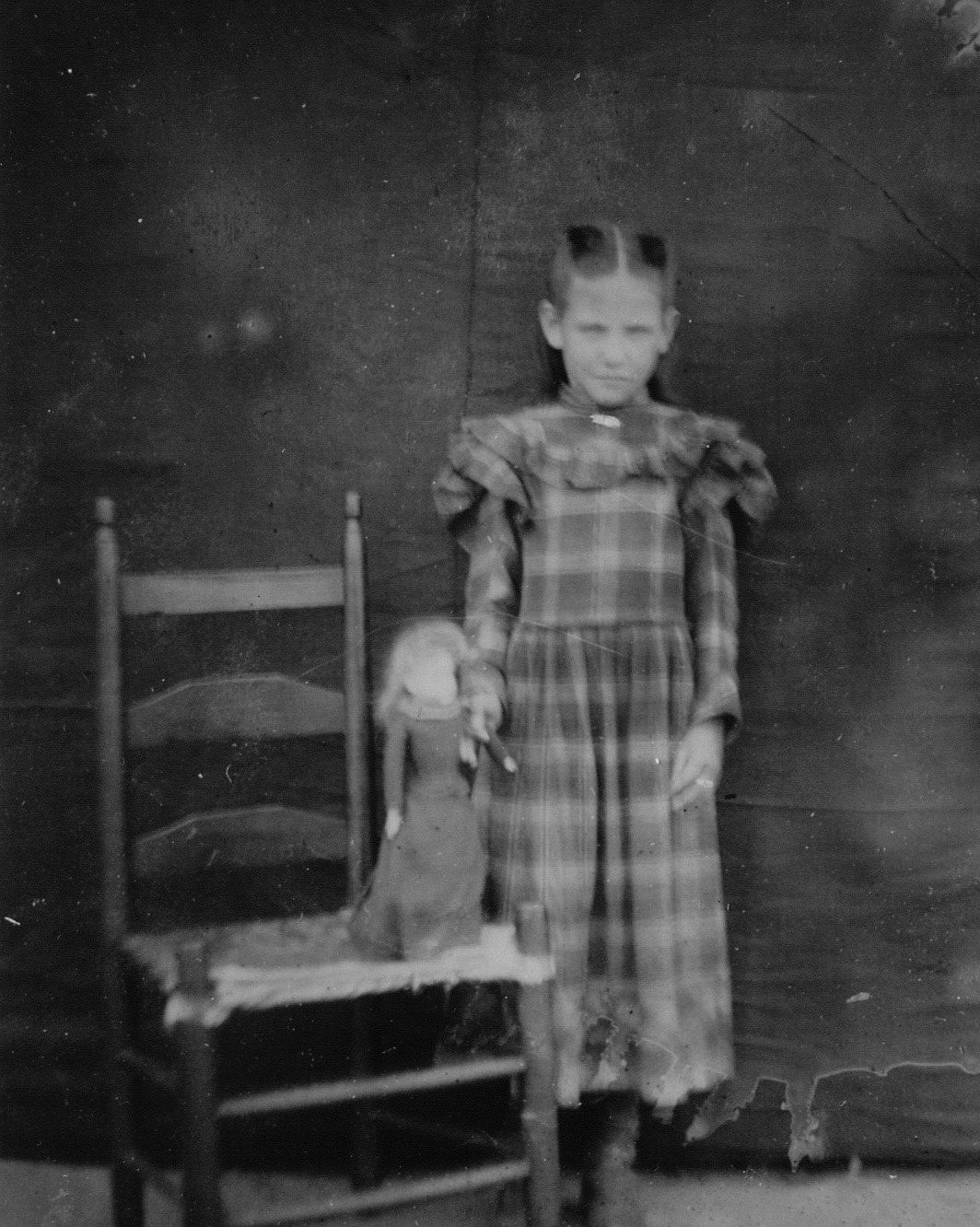


Ella, (left) the youngest Stevens girl, married A.K. Spivey, who died in 1911. The Spiveys, who lived on the corner of Gaines and Washington Street,  had four children;  O.W. Spivey, of Rebecca, Ga., Lavada, (Mrs. D.F.) Bush, Bonnie Belle (Mrs. W.R.) Wynn and J. Hilton Spivey of Atlanta. Ella, who died in 1934, three years after the Courier Herald interview, is buried in the cemetery of Bethlehem Baptist Church at Condor, near East Dublin.


The oral histories of the Stevens girls gave us some insight into how life was like in the decades following the Civil War, which ended 150 years ago.  Please take the time and sit down with a senior citizen and record the stories of their lives so that those who come after us can take a remarkable glimpse back into our past.


BLACKSHEAR’S FERRY, LEGENDS AND MYSTERIES

As the construction of a new bridge over the Oconee River begins at a place known as Blackshear’s Ferry, let us take a look back at some of the legends and mysteries of one of Laurens County’s most ancient of landmarks.

The first of a series of ferries owned by War of 1812 General David Blackshear and his sons came into operation in 1808.  Two centuries later, eroded by rushing waters,  remnants of this mystical place still remain.  Most of the people who ever rode across the rushing waters on the rickety ferry boat are gone now.    For those who did, their recollections of their youth have now faded.  Like the ancient proverb says, Blackshear’s Ferry never gives its secrets.”  So, let us take a look at some the ancient mysteries which surround Blackshear’s Ferry, some four crow fly miles north of Dublin on the Oconee River.


Rock Shoals


One of the most enduring mysteries goes back more than four centuries.  English colonists under John White settled on Roanoke Island along the coast of North Carolina in 1587.  When White returned three years later, he found the colony completely deserted, except a small sign on which was carved the word “Croatoan.”  One of the myriads of theories as to what happened to the lost colonists was that they traveled south into what would become Georgia some century and a half later.   Legend tellers would swear to you that these wanderers made their way across the Oconee River at the shoals, some quarter of a mile down the river.  While the legend sounds good, like many legends do, you decide for yourself, though logically this legend is probably not true.

Even more cryptic is the legend of the “Indian Spring Rock.”    Julia Thweatt Blackshear saw the rock.  She described it as four feet high and seven feet long.  One of the sides of the rock, which lies about a mile north of the ferry, has been carved as smooth as if were cut by a marble cutter.  Mrs. Blackshear reported that across the face there are written, or carved, mysterious hieroglyphic letters.    Likened to Egyptian characters, these letters have been said to form a long line across the entire surface of the rock.  This legend is true.  What remains a mystery is where the rock is.  Did Mrs. Blackshear mean true north, which would put the rock somewhere in the vicinity of Springfield, the home of General David Blackshear.  Or did she mean, north along the river near where Blackshear’s original ferry once was located?  If so, on which bank did she mean?    For all you mystery solvers, this is one you solve.  The trouble is, with the ever changing course of the river, the legendary “Indian Spring Rock,” may now be submerged waiting for millennia before someone deciphers its ancient message.

Interestingly just down the river from the ferry on the eastern bank of the river is another mysterious rock.  Lying on the steep slopes of Carr’s Bluff is a limestone rock similar in size, but not in shape.  Lying on its side, the rock resembles half of a perfectly split  elongated heart.    While there are no markings on this rock, which is similar in size, it is puzzling how this massive rock came to rest some fifty feet up the side of a near cliff.     This rock does exist. The question remains, “How did it get there?  Was it rolled down the cliff as an anchor  by Jarred  Trammel and James Beatty, who established their own ferry there at the point where the ancient Lower Uchee Trail crossed the Oconee River on it way from the Creek Indian lands in southern Alabama northeasterly to the area around present day Augusta on the Savannah River?  


OLD CANAL

If you walk down the western bank of the Oconee you will find a ditch which runs parallel with the river and at times sinks to a depth of more than twenty feet from the top of the river bank.  The trench, which spans out as wide as a hundred feet, runs in a southwesterly direction from the ferry down to the point where the Lower Uchee Trail intersects with the river bank at a tall bluff at Carr’s Shoals.


OLD CANAL

This is a mystery solved.  In the early decades of the 20th Century, when river traffic was beginning to wind down, but when electric power needs were begin to swell, some thinkers proposed the idea of a canal from the area around the ferry down to Dublin.  The canal would be filled with water.   The proponents believed that since water flowed downhill that the resulting drop in elevation along the route could be utilized to generate electricity at the southern end of the canal.    They also believed that in times of raging high waters and rocky low waters,  flat boats, loaded with cotton and other valuable commodities could be carried by horse and mule teams along a tow path.  To increase and diminish the flow of water along the canal, the builders built gates, one of which can still be seen about half way down the path.  The project failed for the lack of money and utility.

Dr. Arthur Kelly, esteemed archaeologist of the Smithsonian Institution, called them “the most exciting and wonderful Indian mounds that he had seen on his exploration of the Oconee River.”  Situated near the river crossing was the ancient Indian village of Ocute.  It was here in 1934, where Dr. Kelly and his party found an old Indian burying ground with at least eighty to one hundred graves.  Strewn and scattered across the ground were arrowheads and pottery deemed by Kelley as “entirely different from any others found in Indian mounds across the state.

But just where were these mounds?  Were they at the crossing site, which to his dying day Kelly, and his colleagues,  believed was where the Spanish explorer crossed the Oconee in his journey in 1540.  Were they further upstream or downstream nearer the Country Club?    Even though Dr. Kelly warned Dubliners about commercial exploitation of the site and challenged them to raise a mere two hundred dollars to help establish a fund to explore and document the site in addition to Federal help with the labor and volunteer help by the ladies of the John Laurens Chapter of the Daughters of the American Revolution.  Alas, Dr. Kelly went off to Macon to survey what became the Ocmulgee National Monument.  The legendary village of Ocute, or whatever it may have been called, is still there, just waiting for the time when the next archaeologist comes along to reveal the truth about what was really there.

Julia Blackshear in her  article in The History of Laurens County, 1807-1941 names the village as Kitchee, which according to her description would have located just to the north of the Dublin Country Club.  She tells the story of the time when the final council of the residents of Kitchee was held.  Three aged Indians appeared before the great white chief, General David Blackshear, and asked his permission to allow them to remain on the lands of the ancestors and to guard their graves until their deaths.  The General graciously granted their requests and allowed the ancient and honorable  scions to live there in peace.  When the last of the trio died, the residents of the community buried him along the side the other two.    Just where this ancient burial ground lies  remains a mystery, perhaps for the remainder of time.


The area around Blackshear’s Ferry remains an ancient and mysterious place.  Please remember that the area is privately owned and to ask permission before visitation.  Despite the thoughtless efforts of the apathetic, the river, thanks to conscientious sportsmen and river keepers, remains virtually pristine. And keeping it that way along with respecting the remains of a long ago people should always be our goal.  

The Ancient Tumuli at Fish Trap Cut


Laurens County has several documented archaeological sites along with numerous other areas where projectile points and pottery pieces have been found.  The most well known site is the twin mound site at Fish Trap Cut.  This ancient landmark, centered on the two mounds, was occupied by various groups of Native Americans for as many as twenty centuries and as many as twelve thousand years.


The major period of occupation seems to be during the Mississippian period, with minor occupations during the early and late Archaic Periods and the Woodland Period.   Some time in the 9th Century A.D., a culture of Native Americans began to flourish throughout the valley of the mighty Mississippi River.


The culture which lasted for seven centuries stretched from the Gulf Coast to the Great Lakes. Typical of the culture were people who constructed small to massive earthworks for homes, temples and burial grounds.


The Fish Trap Cut  site, typical of a Mississippian site, is located on the west bank of the Oconee River at a point 150  meters wide with a broad flood plain of two miles in width -  the largest section within 30 miles in either direction. The soil there  is Norfolk Sandy loam, a rare type of soil.


There are no signs of Middle Woodland Swift Creek  occupation at the site.  There are minor signs of a Lamar/Bell occupation on the northern edge of the site.  Dr. Mark Williams concluded that the site may have been used  as a camp for people who were migrating south toward the Spanish settlements on the Georgia Coast and Florida during the sixteenth century.  The site may have been the political center of the chiefdoms of the lower Oconee Valley.


The lower mound on the southern end of the site is most likely a ceremonial mound. Recent probes have found very little evidence of any type of cultural material in the mound, which has a diameter of 100 feet at the top and 160 feet at its base.   The mound is flat topped with an average height of three meters and is made of red clay with a thirty inch cover of sand.


The upper mound was most likely the home of the chief and was probably built first. Today it stands in grove of hardwoods and is only two meters in height but appears moderately larger than the lower mound due to its location on a bluff overlooking the river.  Much more cultural material has been found in the upper mound, which has a commanding view of the cut in the river’s edge.


An examination of river maps prepared near the end of the 19th century indicate that the cut was actually the old river bed and not a totally man-made feature.  It is possible that the cut was formed by connecting the riverbank with the upper end of an island in the middle of the river.


After his examination of the site in 1994, Dr. Mark Williams of the University of Georgia determined that the mounds were built during a period from 1200 to 1350 A.D.  It is most likely that the mounds were only inhabited for a period of 50 to 75 years at the most.  The site would have normally been inhabited by 50 to 75 persons. Firewood, the only source of fuel for fires, was soon decimated for a radius of miles.  The people would then move to another site while the vegetation at the old site regenerated.  


Some archaeologists believe that the inhabitants would also be forced to move when their village became infested with insects and in particular, fleas.


The society was built around a "talwa" or "okli" or chiefdom.   The chief was usually an elder member of the community and commanded the respect and honor of all. He served not only as leader, but as a judge and lawmaker.  In order to keep the large number of people under control these chiefs were afforded the status of a diety.


Investigations of the distances between mound sites along the Oconee River valley have revealed an interesting fact.  Nearly all of the mound sites are almost exactly twenty eight miles apart.  The mounds at Fish Trap Cut are 60 kilometers miles below the Shinholster Mound site.  The mounds are almost 60 kilometers above the legendary village site at the junction of the Ocmulgee and Oconee Rivers in lower Telfair County.


Villages were laid out with some forms of fortification ranging from light to heavy.  Some villages used ditches and small earthworks while larger villages used wooden palisades.  The center of the town was usually a plaza surrounded by public buildings and the dwellings of the townspeople. Dr. Williams and his team found evidence that a village was located between the mounds beginning around 100 B.C.


The village was laid in a circular pattern about two to three hundred meters in diameter with at least eight houses.  The pottery shards found here are those from the Deptford period.  Deptford period pottery was predominant during the latter part of the early woodland period. The village, 200 meters wide and 300 meters long,  is the earliest known Woodland village site in Georgia.


The majority of the Fish Trap Cut site, named the Sawyer site, by Dr. Williams, is owned by the Laurens County Sportsmen’s Club.  The upper end, including the upper mound, is owned by the Archeological Conservancy, based in New Mexico.


The site at Fish Trap Cut is one of only two places in Laurens County which are currently listed on the National Register of Historic Places.  To travel to the site, travel south from the Laurens County Courthouse on Georgia Highway 19.  Cross Interstate Highway 16 (take exit 52 if traveling along I-16) and take Sportsmen’s Club Road (first paved road on the left) and follow it to the river.   The upper mound is on your left and the lower mound is on your right in the club’s complex.  Please contact the site manager before entering the site.


When you visit the mounds, remember they are one of our most treasured cultural resources and as such, should be treated with utmost dignity and respect.  Digging on the site for artifacts is absolutely prohibited by Georgia law.  If you want to look for arrow heads  (points) there are virtually hundreds, if not thousands, of places to find them throughout the county.


FOR MORE INFORMATION GO THE WEBSITE OF THE LAMAR INSTITUTE OF THE UNIVERSITY OF GEORGIA.

http://www.thelamarinstitute.org/images/PDFs/publication_32.pdf


Laurens County, Georgia's Revolutionary War Veterans' graves


The Known Graves of Laurens County's soldiers of the American Revolution.  Courtesy of Loree Beacham and Billy Beacham, the Laurens  County Historical Society and the Find A Grave project.


Gen. David Blackshear
War of 1812
Private, N.C. Militia
Blackshear Cemetery


Peter Calloway
Pvt. N.C. Militia
Blackshear Cemetery


Benjamin Darcy/Darsey
Pvt. Georgia Militia
Buckhorn Methodist Church


James Darcy/Darsey
Lt. Georgia Militia
Buckhorn Methodist Church


William Darcy/Darsey
Major Georgia Militia
Buckhorn Methodist Church 


The Darcys/Darseys
Buckhorn Church


John Shine
North Carolina Militia
Blackshear Cemetery


SHEEP HEARDING IN LAURENS COUNTY


SHEEP HERDING  IN LAURENS COUNTY


For most of the Nineteenth Century the pastures of Laurens County and its neighboring counties  were covered with sheep. The sheep came to this area as a result of the influx of Scottish Highlander families into east and southeast Central Georgia in the decades following the War of 1812.   While no records of the numbers of sheep exist prior to 1850, many sheep grazed on the Wiregrass lands along with the cattle brought in by the Scots.

While cotton was a major cash crop of our area, wool production continued to grow until the beginning of the Civil War.  Most of the uniforms of Georgia's Confederate soldiers were made from wool and not cotton.

In 1850, the United States began taking a census of agricultural activities for the first time.  During that year there were 7606 head of sheep.  Forty one farmers had over fifty  head.  Sixteen of those owned more than one hundred.  The largest sheep farmers were those men who owned the largest plantations.  Samuel Yopp had five hundred sheep on his plantation between Dublin and Dudley. That year, the sheep produced a half ton of wool.  Nathan Tucker, a large plantation owner in the extreme northeastern corner of the county had 366.  Freeman H. Rowe and Gov. George M. Troup had over two hundred head each. Other farmers who had over hundred head were David Harvard, James Stewart, E.H. Blackshear, Reuben Warren, A.C. Hampton, Henry C. Fuqua, Samuel Miller, James Barlow, James Stanley, James White, and Josiah Gay.  

In 1860, there were slightly over one-half million sheep in Georgia.  In Laurens County the number had declined to just over six thousand.  The number of men who had one hundred head remain about the same.  While large sheep herds were scattered all over the county in 1850, a shift had already occurred by 1860.  The largest sheep owners were Nathan Tucker, James Stewart, Freeman Rowe, and Samuel Yopp.  The major sheep herds were located in three areas.  The first area was located along the northeastern line of the county from the current day Highway 80 northwest to the Buckeye Road.  Large sheep farmers in this area were A.J. Hilburn, Dougal Stewart, Alexander Graham, Aaron Odom, C.S. Guyton, Nathan Tucker, and E.H. Blackshear.  These seven men owned twenty seven percent of the sheep in the county.  Another concentrated area was along the southwestern line of the county from the Cadwell area northeast toward Montrose.  Large sheep farmers in this area were John White, Benjamin Burch, Robert Faircloth, Alcy Faulk, Allen Thompson, Hayden Hughes, Samuel Yopp, and John W. Yopp.  These men owned twenty percent of the county's sheep.  One other large sheep farmer was Freeman H. Rowe, whose farm was located at the southern tip of Dublin from the Oconee River west to Telfair Street.

During the Civil War and its aftermath, the number of sheep in Georgia plummeted to sixty percent of its pre-war level.  On the other hand, the number in Laurens County rose to 8502 in the 1870 Census.  Slightly more than eleven tons of wool was clipped in the year preceding the census.  The number of sheep was only slightly less than the number of cattle and swine.

Nineteen men and one woman, Mrs. Nathan Tucker,  owned over a hundred head of sheep in 1870.  The largest farmers in the county were James Stewart and John White who each owned five hundred.  James Stewart clipped fifteen hundred pounds of wool, while John White reported that he had not clipped any.  Aaron Odom was the third largest farmer with 450.  Sheep farmers who were increasing their herds were Vaughn Hilbun, Josiah Gay, J.T. Rogers, U.G.B. Hogan, Samuel Roach, David Alligood, J.G.F. Clark, John Wynn, Benjamin Burch, Wright Nobles, Rachel Robinson, and James Herndon.

In 1880, another dramatic shift began to occur in sheep farming in Laurens County.  Only Warren Carter, Duncan Graham, and John Holmes had more than seventy five sheep in the northeastern part of the county.  Production in northwestern and southeastern Laurens County was minimal.  Hardy Alligood of Hampton Mills District had thirteen hundred head with nearly four hundred lambs being born during the year.  Most of the large sheep farms were then located in the Pinetuckey District which encompassed the southern quadrant of the county.  Alfred Burch had slightly over one thousand  head while William Burch had seven hundred head.  Other large farmers were Benjamin Burch, Ben Burch, Hardy Gay, James B. Gay, Wm. B.F. Daniel, John McLendon, John White, John G.F. Clark, John Grinstead, and Jasper Gay.


Sheep herding became more profitable than cotton farming, despite the ravages of dogs who killed many of them.  Sheep thrived on the grasses in the open ranges of southeastern Central Georgia, known as "The Wiregrass."  The prime range stretched westerly from Bulloch County toward Telfair and Laurens and thence southwest toward Worth and Berrien Counties.  In 1890,  there were four hundred and forty thousand sheep in Georgia.  Thirteen thousand one hundred of them were in Laurens County.  The number of sheep outnumbered the total number of cattle, including milk cows.  It may have been a poor year since the wool clip had dropped to nine thousand pounds.  Within ten years,  the numbers of Georgia sheep decreased by forty percent.

Laurens County finished a close seventh in the number of sheep in Georgia in 1890 coming within seven hundred of fifth place.  Laurens County's position was mainly due to its tremendous size.  The leader was Emanuel County which had nearly twenty thousand and clipped over two and one half pounds per sheep compared to the three quarters of a pound produced by Laurens County's sheep.  Other counties ahead of Laurens were Bulloch, Berrien, Tattnall, Worth, and Telfair.  The forty two hundred sheep of Johnson County produced over two pounds of wool each.

The number of sheep began to steadily decline in the 1890s.  With the clearing of timber lands in southern Laurens County and the improved use of fertilizers, farmers turned to cotton which became more profitable than wool.  The practice of sheep herding  disappeared in our area.  Although long forgotten, it was a major part of the agricultural activity in our county for nearly six decades.

Friday, June 19, 2015

BASIL HALL, THE TRAVELER


BASIL HALL
THE TRAVELER


Sir Basil Hall made it his mission to travel throughout North America.  He sought out to explore and chronicle the former British colonies known as the United States of America.  Sir Basil made his way through the forests and streams of Middle Georgia during his journeys in America in 1827 and 1828.

Basil Hall was born in Edinburgh, Scotland on the last day of 1788.  At the age of thirteen, Basil joined the Royal Navy.  While still in his teens, he was commissioned a Lieutenant.  In nearly all of his travels, Basil kept a journal of his daily activities.  Possessing an intense attitude for science, Hall gave details accounts of his observation of nature, as well as the cultures of the lands he visited.  The son of eminent geologist Sir James Hall of Dunglass, young Basil logged copious notes for future scientific papers.  Still in his twenties as a naval captain, Hall was one of the first officers of the British navy to visit Korea, writing of his travels to that far
eastern country as well as those in Japan and China.  In the 1820s, Captain Hall traveled along the western coasts of Mexico, Chili and Peru.     

Just after the Ides of March in 1828, Sir Hall arrived in the ancient city of Savannah.  He commented that the houses of Savannah lacked the charming piazzas and verandas of  her sister city of Charleston.  Though he admired the tasteful way in which the city had been laid out in squares, he lamented that her wide streets prevented the necessary amount of shade of the oak trees along the sidewalks.  Hall thought Savannah's designers would have been well advised to have copied the designs of the French planners of the city of New Orleans.   Hall traveled south along the coast to St. Simons and Darien, where his fellow countrymen had settled nearly a century before.  After several days, Hall and his guides traveled north toward Riceborough and Augusta.  

Traveling west from Yam Grandy Creek on the 24th day of March, Sir Basil's entourage reached the banks of the Oconee River, which he described as "a dirty stream."  He took dinner in a home in eastern Laurens County.  Their meal was somewhat forgettable.  Hall wrote, "When dinner was ready, we were favored with the company of the mistress of the house, who, however, neither ate, nor spoke, nor gave us one look of welcome; but sat at the top of the table, steadily watching all we did. The formality of this superintendence was sometimes not a little oppressive."

Upon his arrival in Dublin on the morning of March 26, 1828,  Sir Basil immediately saw the tell tale signs of a withering town which he deemed to be "the result of mushroom growth of rapid and unthinking speculation."  Hall wrote in his journal, "The inhabitants of some of these juvenile but decaying towns explained to me, that much of the evil which I saw arose from the unfortunate description of their laboring population."  Hall noticed that whites worked, as they expressed to him, with a clog around their feet, like convicts.  "We sir," said a worker, "we are the slaves, not the blacks; we cannot make them work as men ought to work, neither can we get rid of them, nor supply their place with better subjects; they hang about us, and grow up, increasing and multiplying our curses.  They are the only people who do not care how things go on.  You see them always happy, and they have no wants."

Basil Hall concluded  that as his caravan moved further from the coast, the condition of the Negroes he observed improved dramatically.  "We often saw them working in the same field with white men; and I more than once saw a black man seated in the same room with a free person - a thing never dreamt of elsewhere.  They appeared to be better fed, and better dressed also, than the Negroes of the coast; and, from all I could hear, were fully better treated in all respects, and no son generally kept in ignorance.  The beneficial effects of this difference in the condition of the slaves, even to the masters, I was rejoiced to learn, was generally acknowledged."

The  journey continued in a westwardly direction.  As the sun was straight overhead  Hall reported the scenery change.  He noticed that they were leaving the seemingly endless pine barren.  Instead of the dreary forests, the woods were covered with "cheerful oak openings."   The fields were covered with Indian corn and upland cotton.  "The surface was very prettily diversified by irregular high grounds, and wooded glens, decked with peach trees, all in full blossom.  The dogwood, also, which bears a snow-white flower, was in great beauty, together with our old friend, the honey suckle, growing as a tall independent shrub, and giving much interest to the underwood part of the scenery.  

They entered Twiggs County after a long day's journey of more than thirty miles; the voyagers stopped at a house, which they had been told, was open to travelers.  No one appeared to be home. They found a young Negro boy, who found a cook, who with a little bribery, found the keys and opened the mansion.  Their hopes of a quiet meal vanquished when the daughter of the house sat quietly staring at them, as if they were a pack of wild beasts feeding.  Hall wrote, "the show, I presume, was too good to be lost, for the cook, shining from the kitchen, together with her black daughter, and her black son, and one or two more half-naked Negroes, came into the room, and continued moving about during all the time of dinner on one pretense or other, but, in reality, merely to see how the strange people ate their food."  

Sir Basil Hall arrived in Macon on March 27th.   Macon was just in its infancy.  Just as he had written about Dublin, Hall's comments about Macon were less than flattering.  After a brief stay, he proceeded on his westerly course toward Alabama.  In 1829, Sir Basil Hall published his accounts of his travels in America under the title of Travels in North America in the Years of 1827 and 1828. The work was blasted by American critics for his seemingly distressing views of American society.    

During his thirties, Hall traveled through southern Europe.  He compiled a nine volume work which he titled The Fragments of Voyages and Travels.    Basil Hall completed his last work Patchwork, a collection of sketches,  in 1841.  

Insanity marred the otherwise remarkable life of Sir Basil Hall.   For the last two years of his distinguished life, Basil Hall lived in torment.  He died on September 11, 1844 in Haslar Hospital in Portsmouth.     

Sunday, April 12, 2015

LAURENS COUNTY TURNS 200

Reflections of Two Centuries


Out of towners often ask, "What's the greatest thing about Laurens County?" They ask, " Do you have anyone famous from here?" I say, "It depends on what you mean by famous." I also say "We are the home of the parents of several famous people." Then they say, "Did you ever have a Civil War battle fought here?" I respond by saying, "No but if the Union cavalry had been here one day earlier, Confederate President Jefferson Davis would have been captured here and there would be a monument and museum to commemorate the event. Then I go back to the first question and say, "Well, the greatest thing about Laurens County are her people." I tell them about the life long friendships we have, fellowships which transcend race, religion and social status. Then I tell them how when ever something really needs to get done, there are usually a group of people here that will get it done, though there is always a corps of doubters and apathetic "do nothings" here and for that matter everywhere.

But when my mind really concentrates, I think about the heroes and those who excel in their triumphs of the human spirit. I think about the heroes of the armed services. From the last great war of World War I, to the big war of World War II, to the so called "police action" in Korea, to the misunderstood and maligned war in the jungles of Vietnam, visions of heroes flash through my mind. From Congressional Medals of Honor, to Navy Crosses, to Silver Stars and bronze ones as well, Laurens Countians are unparalleled in their devotion to do their duty for their country. They do it well, with honor, with bravery and they do it in unrivaled numbers. Even in today's mix of regular army and national guard soldiers, more of the citizen soldiers come from this part of Georgia than any other section of the state. We have served our countries from Gettysburg to San Juan to Marne, to Normandy to Hue. No county, and I mean, no Georgia county can match the heroism, gallantry and bravery of Laurens.

Donning a uniform is not the only form of public service. We have served as governors, senators and representatives, both at state and federal levels. Laurens Countians have led the departments of Justice and Agriculture at the capital. Laurens Countians have served on both the Supreme Court and Court of Appeals of Georgia. Service is not left only to the politicians and the lawyers. Think of the thousands of us who have worked for decades as school teachers, most of the them for a mere pittance. Then there are the public safety employees who work, train and risk their lives while the rest of us sleep, eat and play. The next time you see one of these underappreciated and woefully underpaid public servants, shake their hand, buy their supper or simply say "thank you."
 
Do the math. If every one of the forty five thousand plus residents of this county performed only one hundred hours of volunteer service that would mean that there would be 4.5 million hours of helping each other. Anyone can do it. Everyone should do it. Don't just think about it. Do it!

Throw adversity at many Laurens Countians and you'll find a champion when the dust clears. Time after time, especially in recent years, the young men and women of Laurens County have shown the entire state that they are champions, not only in athletics, but champion kids as well. We have won world championships in baseball, football and basketball. We have played in the Masters Golf tournament, raced at Daytona and repaired the race cars of Grand Prix champions. Many have been named to All American teams across a broad spectrum of sports. One Dublin teacher was once billed as the fastest man in the world.

Champions of the business world can call Laurens County home. Georgia Power Company, the Atlanta Constitution, the Federal Reserve Board and the Coca Cola Company were led by folks from here. Two of us have served as Imperial Potentates of the Shrine of North America, who make it their mission to help needy children.

When all doubts are out of the shadows, the women of our county shine as brightly as anywhere else. For more than eight decades, the fairer sex have shown they can remarkable things. They were the first woman to be a Georgia judge, the first woman deputy attorney general, the first woman to head a medical department of a major black university and the first woman in Georgia to be a licensed dentist. One Laurens County girl founded the first sorority in the world. Another, Gen. Belinda "Brenda Higdon" Pinckney may retire from the United States Army as one of the highest ranking generals, either black or white, in the history of the Army. Heck, one Laurens County man, as governor of Georgia, appointed the first woman to serve in the United States Senate. Our women have been here from day one, garnering few headlines. If you look at IT, they are the reason the headlines were here in the first place. Hug your mom, kiss your wife and encourage your daughter, "You go girl, there's nothing you can't do."

Then there are the thinkers and those who excel when thinking outside the box is a good place to think. In the 1920s and 1930s alone, ten Laurens Countians were writing for major newspapers and magazines around the country. Dr. Reece Coleman helped to develop the first color camera to film the inside of a living human being. Capt. Joseph Logue, former director of the Naval Hospital, reacted to the complaints of the U.S. Marine Corps and ordered the first use of DDT to combat insect bites during World War II.

And last but not least, there are those who refuse tot believe "it can't be done." Take Claude Harvard for example. Harvard, a poor black kid, sold salve to buy a radio, likely the first one in the county. His desire to learn took him to the highest levels of inventions for Ford Motor Company in the 1930s. Major Herndon Cummings and his fellow pilots stood up to the entire U.S. Army and led to President Truman's decision to integrate the armed forces. For the younger crowd, one Laurens Countian convinced networks to air MTV, Nicklelodeon, ESPN 2 and the Movie Channel. Dr. Robert Shurney, who grew up in the care of his grandparents and served his country in war time, went to back to college in his thirties and became, according to many experts, the leading black scientist of the National Aeronautic and Space Administration, all without the benefit of a high school diploma.

The list goes on and on, but no matter how many plaques, awards, citations, hall of fame elections and newspaper headlines we garner, Laurens Countians do what they do because it needs to be done or simply it is the right, or the only thing, they can do. What do all of these people and thousands of others have in common? They are all natives or at one time residents of Laurens County just like you. Ask yourself, can you be champion or a hero? Sure you can and it doesn't take anything special; just serve others in your community and your community will serve you. Don't seek recognition. Just do it, do it well and do it with a passion. The rewards will flow back to you beyond all imagination. As we end the first two hundred years of our county's history, I challenge all of you to remember that our most important history is not in our past, but it lies in our future.